Adapting a historical Map of Madagascar
|
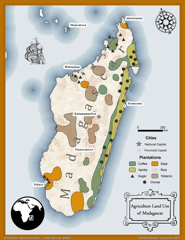
For this project my task was to georeference data from an older agricultural map of Madagascar to a new document. This means using tools to stretch and calibrate a paper map into a digital interface. Once you have the map matched up with a basemap you can begin tracing features digitally, creating new features for the plantation data.
Creating the symbology and placing elements was the most tedious but also most rewarding aspect. The final product is a concise and visually appealing infographic. |
|
